


Backpacking the Grand Canyon of the Tuolumne River

NAVIGATING THIS GUIDE
Planning Tools for ANY Backpacking Trip in Yosemite
Wilderness permits
Any overnight stay in the park either requires reservations if you’re staying at a designated campground or a wilderness permit if you’re camping along the trail.
Click here to reference our section on researching and acquiring wilderness permits in Yosemite.
Top shuttle options for backpackers
Priceless for thru-hikers, the shuttle options below are some of the most under appreciated resources in the entire park. Both shuttles run DAILY, but are operational on a seasonal basis; the YARTS Shuttle even connects with local neighboring towns.
The YARTS Bus Routes. Photo courtesy via: YARTS.com
Option 1: Yosemite Valley to Tuolumne Meadows Hikers Bus - Runs daily from June to September and can be flagged at any trailhead on its route. Prices range from $3-23 depending on the length of the route.
See the link below for routes, fees and other info:
TravelYosemite.com - General Shuttle Info (Note: scroll down to the “Yosemite Valley to Tuolumne Meadows Hikers Bus” section and hit “+”).
TravelYosemite .com - Daily Bus Schedule
Option 2: Yosemite’s YARTS Shuttle - Most lines run daily and depend on season. Prices vary, but are usually between $20-30 at most depending on the route. Tickets can be purchased online in advance or as you’re walking on to the shuttle with cash in-hand.
For high country backpackers, pay close attention to the green line, which runs daily from June through September. It travels between the Yosemite Valley Visitor’s Center and Mammoth Lakes for just $23 each way.
See the link below for routes, fees and other info:
YARTS.com - Official Homepage
Additional Shuttle Options
Complete List of Public Transportation Options In & Around Yosemite - Luckily you’ll find a lot of options here. Check out the link below for a complete list of transportation options in & around the park:
Pre-planning Your Own Shuttle System - If you're doing a thru hike in a group, you may decide to set up a two-car shuttle system. For a list of Yosemite trailheads and destinations for backpackers, see the link below:
High Sierra Camps - Backpacking without the heavy backpack
During warmer months of the year, Yosemite National Park maintains five fully-stocked camping outposts in its beautiful backcountry, allowing all the scenery and adventure of backpacking without requiring visitors to carry backpacks full of cooking and sleeping gear. Available only by hiking or mule ride, these camps are strategically spaced one day’s hike from each other, allowing hikers to link them all together in one continuous Yosemite high-country tour if set up correctly.
Reservations at the camps are available only through a lottery, held once a year in early March. See the link below for more details.
Travel Yosemite - High Sierra Camps
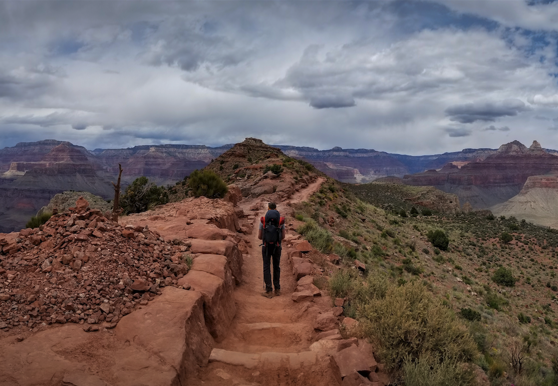
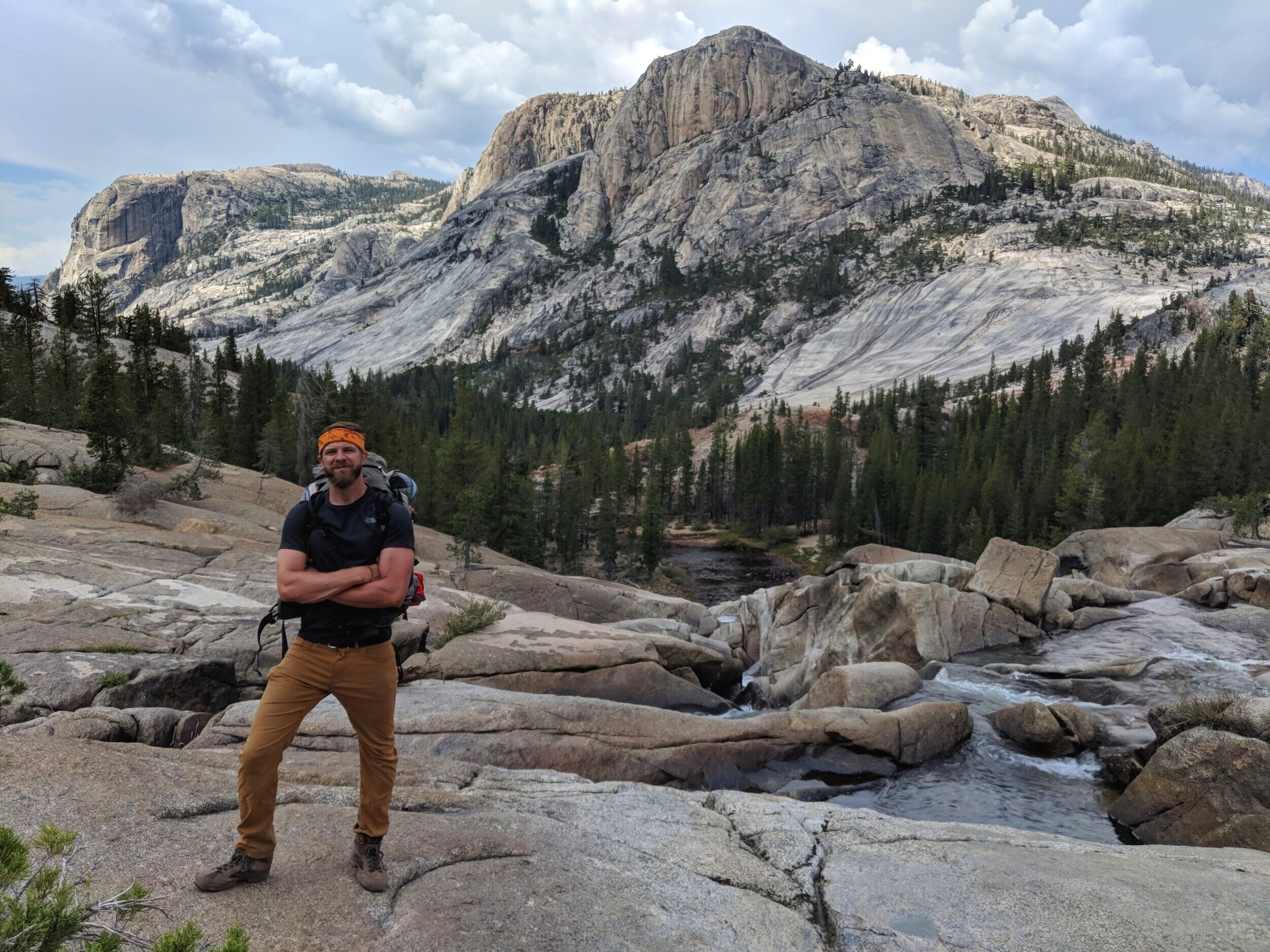
Backpacking Yosemite's Grand Canyon of the Tuolumne River

Overlooking the Grand Canyon of the Tuolumne River from Glen Aulin after a thunderstorm.
Trips Stats
A massive departure from the overwhelming crowds of Yosemite Valley, The Grand Canyon of the Tuolumne River is a remote 3-4 day backpacking adventure through a 3,000 ft. tall Yosemite Canyon the way it was really meant to be experienced.
With its towering granite walls, endless swimming holes and jaw-dropping vistas, this adventure was my favorite backpacking trip of 2018.
Distance - The most common method is a 33 mile thru-hike (3-4 days), using either your own shuttle system or the park’s public transportation options. If you’re hardcore, you can also experience it as a 93 mile (8 day) loop (see below).
Seasonal Timing - Ideal timing is either late spring/early summer or late summer/early fall. I hiked it the first week after Labor Day, and the weather was absolutely perfect.
Elevation Gain - Regardless of which direction you approach from, this trip requires a 3,500 ft. descent into a canyon and back out again.
Elevation is lowest in Pate Valley (4,400 ft.), which is directly downhill (north) from White Wolf campground (7,760 ft.) and highest at Tuolumne Meadows (8,619 ft).
Options for Completing the Hike

The three options to consider on this trip are approaching from the bottom-up, the top-down or a full loop:
Tuolumne Meadows to White Wolf (top-down thru-hike)
I had an excellent experience with the top-down approach. Most of the trip is a pleasant steady downhill stroll, followed by a brief (but steep) uphill battle on the final day toward the finish line. You’ll also maintain a constant top-down view of the canyon for photography. The very best views will be on the first day, but honestly the scenery is jaw-dropping throughout the entire journey. I would not recommend this approach if you have any adversity about the steep uphill charge with a heavy pack on (i.e. people with knee or lung problems).
White Wolf to Tuolumne Meadows (bottom-up thru-hike)
Approaching from this direction, you’ll experience an immediate 3,300 ft. descent into Pate Valley from White Wolf on the first day. The remaining two to three days of this trip is a steady uphill climb with views getting progressively better as you progress. You’ll be rewarded with an endless number of swimming holes with beautiful waterfalls and jaw-dropping vistas on your last day between Glen Aulin and Tuolumne Meadows, something you’ll appreciate even more if it’s hot out.
As an eight day loop
I haven’t experienced this full 93-mile loop, but this blogger maps out a very thorough game-plan for anyone interested in the longer option: LanceSimms.com - Grand Canyon of the Tuolumne River
Permits and Reservations
Because you’ll be camping in the backcountry, this adventure requires a wilderness permit. Luckily, since it lies away from the ever popular JMT, permits usually aren’t too tough to acquire for this trail as long as you’re relatively diligent with the timing of your application (i.e. applying as soon as permits become available).

Acquiring your permit via advanced reservations online
From a daily quota of roughly 70 on this trail (40 campsites near Glen Aulin, 30 near Pate Valley), 60% of the permits for this journey are available online via advanced reservation, which can be made 24 weeks (exactly 168 days) ahead of your start date. Applying in advance will always be your most sure-fire way making definite plans, especially if you have a large group or a rigid timeframe (i.e. weekends only).
Acquiring your permit as a walk-In
If you’re able plan your trip mid-week, this is by the easiest way to get a permit, even during the height of peak season. Roughly 40% of the 70 daily permits available on this trail are available exclusively on a first-come-first-serve basis. Walk-in permits become available at 11am prior to the day you want to start your hike.
If you’re planning on visiting during the weekend, you may want to have some back-up options on-hand, or simply apply online in advance.
Setting Up Your Thru-Hike Shuttle
This trip can only be completed when Tioga Rd. is open during warmer months of the year. That in mind, Yosemite’s park shuttles will likely be running when you plan your trip.
Both the YARTS shuttle and the Yosemite Valley to Tuolumne Meadows Hiker’s Bus stop at White Wolf Campground and Tuolumne Meadows (see details & map above), so you shouldn’t have an issue getting back to your vehicle at the end of your journey as long as you’re successfully able to complete the hike.
Regardless of which location you decide start from, I’d highly recommend leaving your vehicle at the finish line and taking the shuttle at the beginning of your trip as opposed to the end.
What to Pack
Aside from my regular backpacking gear, the standout items on this trip were:
A swimsuit (100%)
Lightweight rain gear in case you encounter any thunderstorms
A good camera - modern day smart phone cameras should be more than sufficient for most people; you may decide to leave the heavy DSLR behind
A park-approved bear box, which you can rent from the same ranger station that issues your permit
An anti-venom kit for snakes and insects, due to the remote location of this hike
A GPS device or emergency beacon for safety (the hike is remote but there are certainly other backpacking groups on the trail to help in case of an emergency)
Trekking poles might be a good option for this trip due to the steep elevation required for either direction

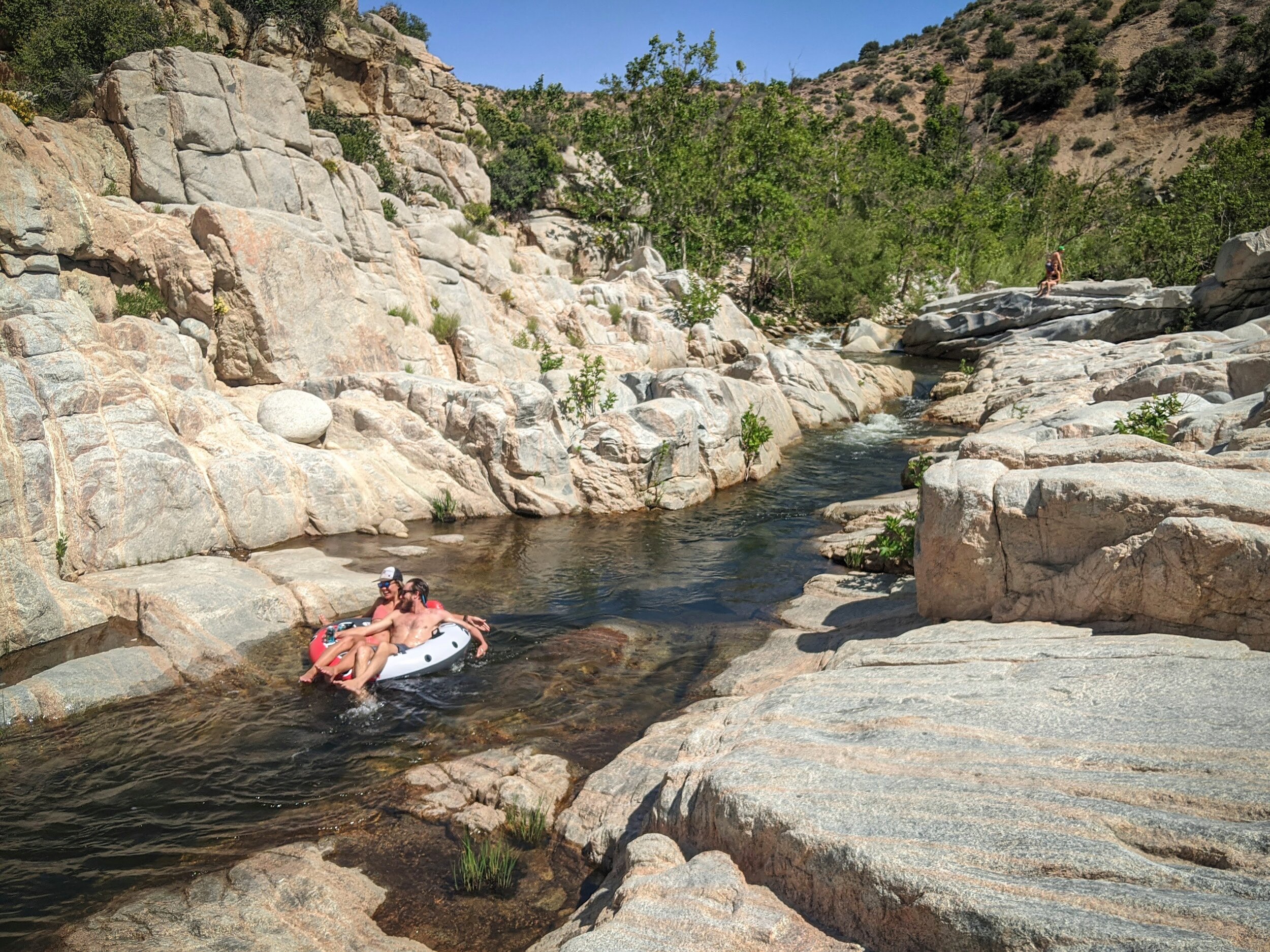
Secret Waterslides
Oh yeah, you heard me
If timed perfectly, some of the long, shallow waterfalls along this hike hit the goldilocks water level and create ideal waterslide/ slip-n-slide conditions, usually a 2-3 week-long window in July, depending on snowpack from the previous winter.
If you’re lucky enough to catch this window, bring floaties, waterproof cameras and anything else you need to maximize these rare opportunities.
Safety and Unexpected Challenges

Scanning the horizon along the Tuolumne River before a heavy thunderstorm
Expect High Sierras weather
Have a game plan for bad weather and thunderstorms. They’re very common from July through September, and aside from the high Sierra camp Glen Aulin, you’ll find almost no protection from the elements aside from tree cover.
Critters!
Watch out for heavy bear, snake and raccoon activity in Pate Valley and lower elevation areas on this hike. I ran into a bear (nearly face-to-face) on the upper end of Pate Valley on this trail.
The hike is remote in the best way possible…but still remote
A stunning change of pace from the rest of the park, The Grand Canyon of the Tuolumne is very remote. The second day on the trail, I saw two other hikers….that’s it.
Additional Resources
Bearfoot Theory - Trail Guide: Backpacking the Grand Canyon of the Tuolumne in Yosemite
ShoutIntoTheWilderness - Backpacking the Grand Canyon of the Tuolumne


Want More Adventure??
Check out our other popular blog posts: