

Backpacking Cottonwood Lakes & Mt. Langley Summmit
This is an incredible backpacking experience
Beginners and experts will both love this trail
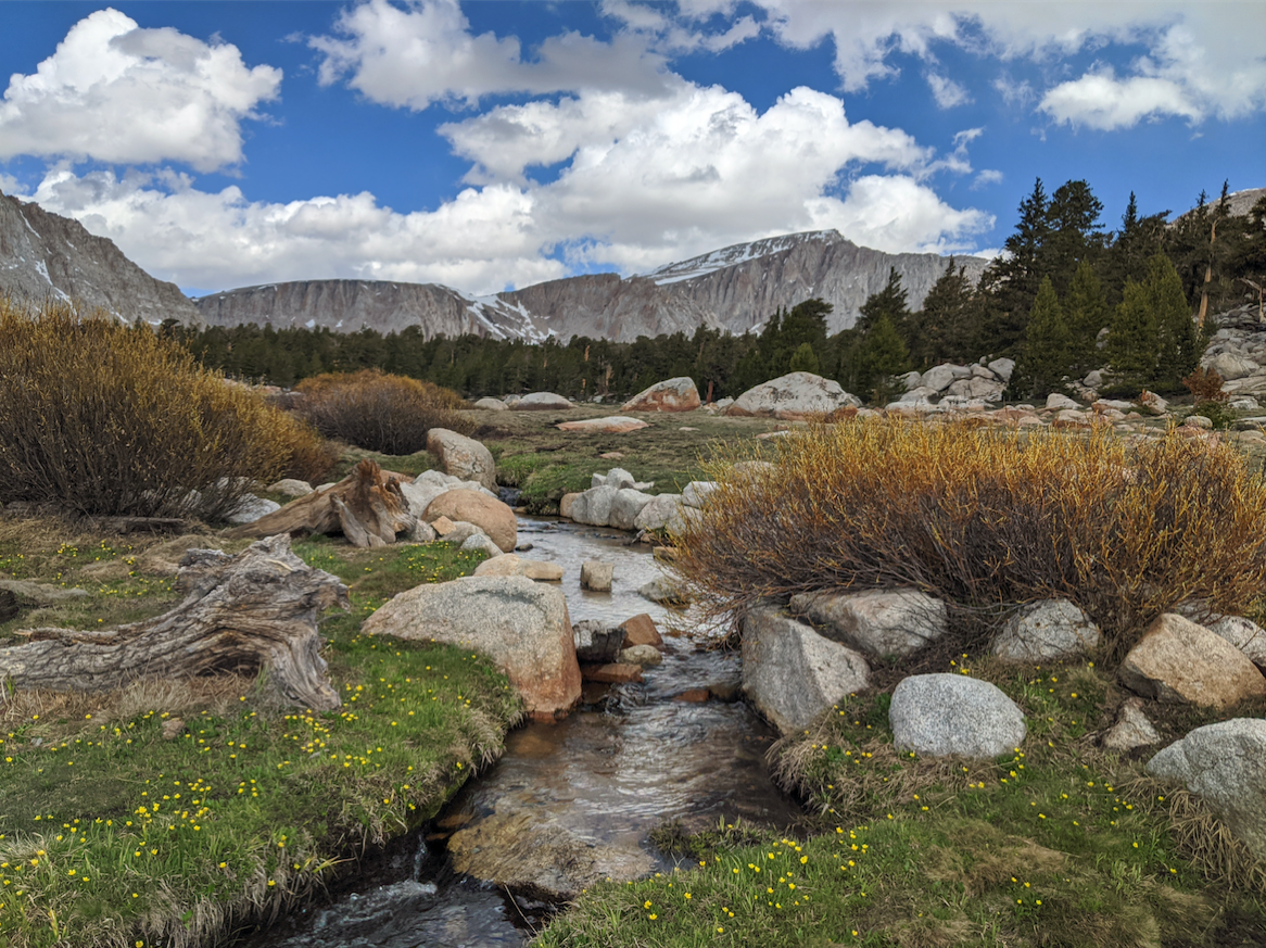
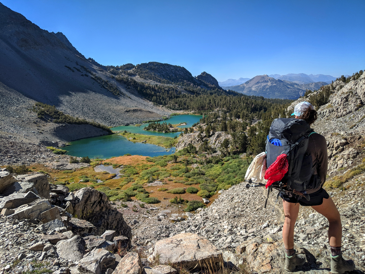
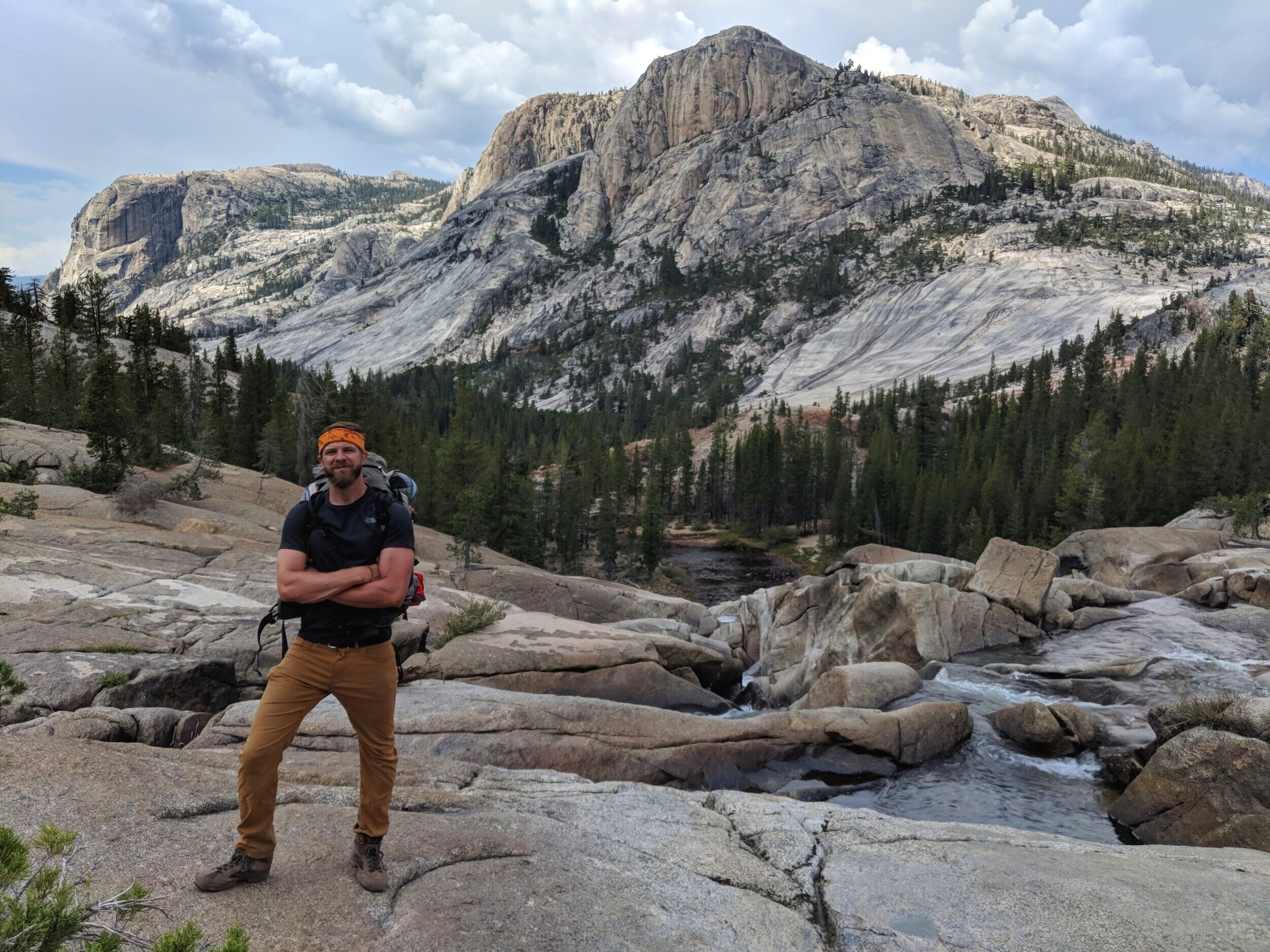
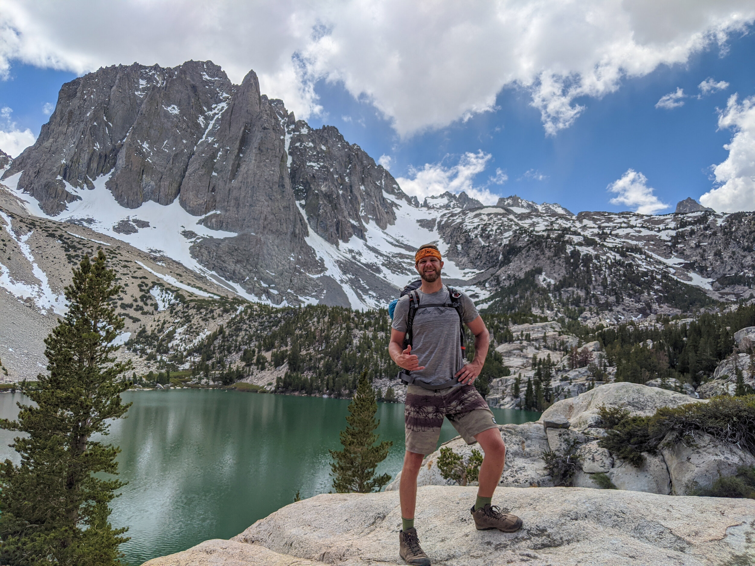
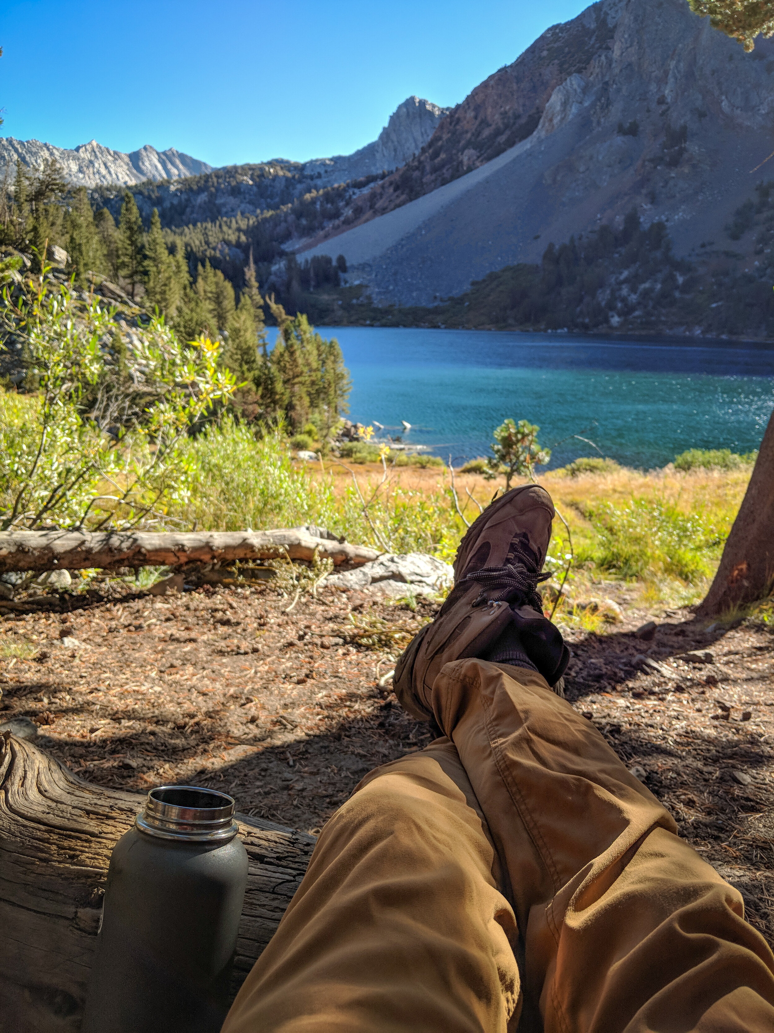
Lush green boulder-strewn meadows, crystal blue lakes, towering jagged amphitheater-style crag walls and twisting gnarled Fox Tail Pines will have you wondering what the hell took you so long to take on this hike. It will also make you dread returning to your 9-5 job (no joke). I promise it’s worth it—just don’t blame me if your work performance sucks for a few weeks after your trip.
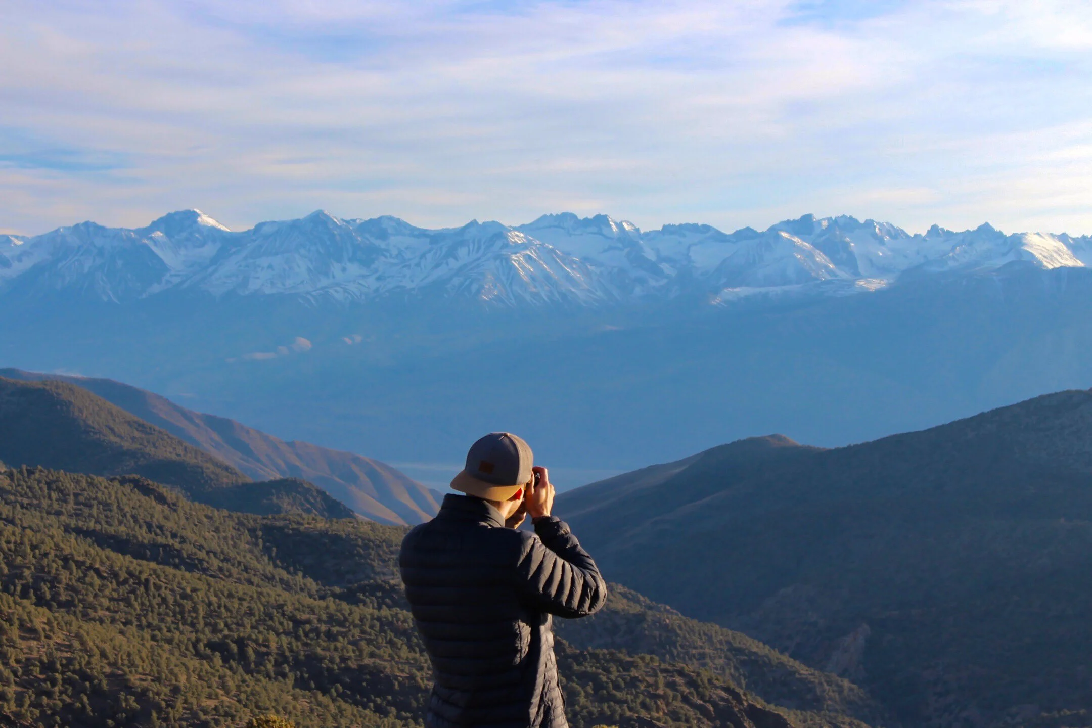
Located just south of Mt. Whitney, this trail held nothing back and exceeded already high expectations. A smooth, standard hiking trail will have you wondering what the big deal is, until you turn a corner and are hit head-on with the full Sierra Nevada experience that doesn’t let up.
This trail is a perfect experience for both beginners and experts. First-timers have a gradual, stress-free hike to the Cottonwood Lakes Basin; experts can continue on to the epic 14,000 ft. summit of Mt. Langley. Both will be equally impressed by the beauty.
For all of the above, did we mention it receives a small fraction of the traffic that Mt. Whitney sees??
When to Plan Your Trip
Here’s what you can expect during each month of the season
These windows align with a typical season but always depend on that year’s snowfall:
Late May to Early June — Midweek in late May, 2020 (below average snowfall season), we had the entire amphitheater surrounding lakes 4 & 5 to ourselves (including lake 3, where we camped). DIDN’T SEE A SOUL the entire day, aside from a pair of thru-hikers while traversing the basin on the way in. We sat on a 20 ft. boulder, drank whiskey and howled freely at the rising moon. We would NEVER have experienced that kind of solitude between July and September.
We were still surrounded by some snow in the mountains, which intensified the high alpine spectacle, but also blocked us from scaling Old or New Army Pass. If you’re primarily looking to experience the Cottonwood Lakes basin, midweek in May is an ideal time to go. If you’re planning to summit Langley, I’d recommend pushing your trip a month or two further into the season.
Because snow levels fluctuate year-to-year, contact the ranger station to verify ground clearance before setting off.
July & August — Snow in the Cottonwood Lakes Basin will likely be gone by the end of June (May if it’s a low season). Snow on or near Langley’s summit will depend on the year (check with the ranger station—contact info below). Yes, you’ll have more mosquitos…bugs gotta eat too. On the bright side, the entire meadow will be more lush, green and beautiful during the first half of the summer.
September — September is your sweet spot for weather & conditions. Temperatures are high but not scorching, mosquito activity falls off from July & August levels. It will also be the most popular time of year for crowd activity. If you plan on visiting in September, you’ll be better off going mid-week if possible.
October — There’s a window of time in October where the summer crowds die off before winter temps freeze your nips off at night. Hit that window, and you’ll likely have the whole mountain to yourself.
Note: Because this is a popular trail, I’d highly recommend going mid-week if possible.
Trail Stats
Distance
Backpacking up to Lakes 4-5 — Exactly 11.5 mi. round trip—6.5 mi. out, 5 mi. back if you follow the loop clockwise
Mt. Langley Summit via New Army Pass — Roughly 26.5 mi. round-trip
Mt. Langley Summit via Old Army Pass — Old Army pass is slightly shorter than New Army Pass (possibly up to 2 mi.).
Elevation
Despite the elevation, the hike up to Cottonwood lakes isn’t too brutal. The Langley summit, is a different story. At least you’ll be semi-fresh until that point.
Trailhead Elevation: 10,066 ft.
Cottonwood Lakes Basin: 11,200 ft. (1,134 ft. gain)
Mt. Langley Summit: 14,042 ft. (3,976 ft. gain)
Options for Completing the Hike
Cottonwood Lakes Basin only - Great for beginners
The Cottonwood Lakes Basin, even without the Mt. Langley summit, is incredibly beautiful on its own. If you’re looking for a High Sierras 101 trip for a first-time backpacker, It’s the best route I’ve seen to date.
Aim to set up your camp either on the far end of Lake 3, or even more ideally, on Lakes 4 or 5. The campsites at lakes 4 & 5 are the crème de la crème in terms of visual beauty, but offer little protection from weather or wind exposure. Head there first. If conditions aren’t ideal (or spaces aren’t available) you’ll find no lack of beautiful camping terrain at the lower lakes.
Cottonwood Lakes to Mt. Langley summit - Intermediate & expert
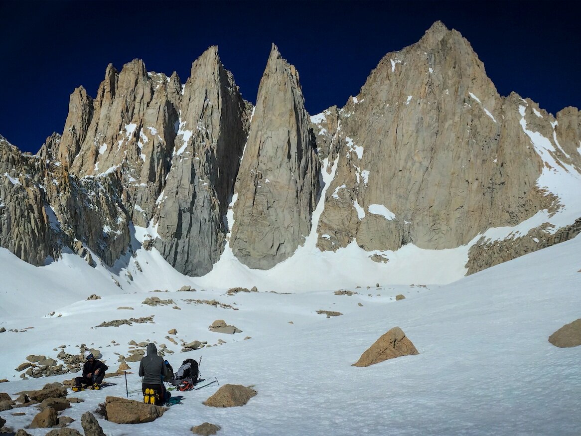
M.t Langley is the 9th tallest mountain in California and one of a small handful of 14,000 ft. peaks in the state that can be summited via a class-1 hiking trail. For any aspiring peak baggers out there, this is a great place to start.
Old Army Pass is a steep but brief off-trail route that ascends straight up the amphitheater wall surrounding Lake 4. It’s a shorter and more direct route to the summit, and many would argue more beautiful since it passes directly through the extra-scenic lakes 4-6 of the Cottonwood Lakes Basin. Before committing to this route, note that Old Army Pass is more steeper and more dangerous. It is non-technical Class 3 hiking route blanketed by a thick pile of loose scree and is usually covered in snow aside from 1-2 months in the year. Given all of the above, the route should be clear if you’re hiking during August or September, allowing you to both shave off some distance while simultaneously experiencing the stunning Cottonwood Lakes area.
New Army Pass, while slightly longer, is an easier and well-maintained trail preferred by most people attempting the Langley summit. It also gives hikers access to other sections of the PCT and John Muir Wilderness, as opposed to purely just the peak of Langley.
Permits and Reservations
STEP 1 — Find an available permit on Recreation.gov (or as a walk-up)
Between May 1 - Nov. 1, this hike allows permits for 60 overnight hikers per day, most of which may be reserved ahead of time. The remaining permits are set aside as walk-up permits, available after 9 AM the day before your departure. Permits can be reserved at Recreation.gov (look up JM39: Cottonwood Lakes) up to six months in advance. Day hiking does not require a permit.
Do NOT select Cottonwood Pass. it’s a completely different trail.
STEP 2 — Select your campsite
Because it’s a lollipop style hike, both your entry and exit point will be JM39: Cottonwood Lakes
The only required information is the lake you’ll be staying at. Here are my recommendations:
Lake 1 & 2 - Decent option if you plan on summiting Langley via New Army Pass
Lake 3 - Great option if your final destination is the Cottonwood Lakes Basin, or if you plan on summiting Langley via Old Army Pass (see above)
Lakes 4 & 5 - Best option if the weather is good (i.e. no heavy wind/rain) if your final destination is the Cottonwood Lakes Basin, or if you plan on summiting Langley via Old Army Pass (see above)
Lake 6 - A stone’s throw higher than Lakes 4 & 5 with an equally stunning view and likely less people
High Lake / Long Lake / New Army Pass - Best options if you plan on summiting via New Army Pass
Muir Lake & Hidden Lake - Separated lakes on the northeast pocket of the Cottonwood Lakes Basin. They’re out of the way and slightly less scenic than the other lakes; I’d avoid it unless you’re looking for seclusion above all else.
STEP 3 — Select the ranger station where you’ll be picking up your permit
Arrange to pick your permit at the Ranger Station below no later than 10am on the day of your departure:
Eastern Sierra InterAgency Visitor Center, Hwy. 395, 2 miles south of Lone Pine, CA
Permit Reservation Resources
Recreation.gov - Inyo National Forest Permit Reservation Page (Select JM39: Cottonwood Lakes)
US Forest Service - Inyo National Forest Wilderness Permits
Inyo National Forest Wilderness Permit Phone Number: (760) 873-2483
What to Pack
Just a quick list of things not to forget
The 10 essentials along and your regular backpacking & first-aid gear
A bear canister is required
A water filter and/or purification tablets
Consider a lightweight rain jacket. Thunderstorms are known to roll in during summer afternoons in the Sierras. I was caught in one on my own trip. Just something to be mindful of.
DSLR camera - Given the views, this one is worth hauling up that heavy DSLR camera. Bring a wide-angle lens.
Day of the Hike
Starting your trek
After picking up your permits at the Eastern Sierra InterAgency Visitor Center in Lone Pine, follow Whitney Portal Rd. to Horseshoe Meadows Rd. Take it all the way up to the Cottonwood Lakes Walk-In Campground.
Avoid any road signs leading you to Cottonwood Pass—you’re looking for the Cottonwood Lakes Trail, noted by the campground near the trailhead.
Nearest Ranger Station - Eastern Sierra InterAgency Visitor Center: Lone Pine, CA - (760) 876-6222
Shuttle Required - None
Turn-By-Turn Instructions
HikesPeak - Mt. Langley Summit via New Army Pass
AmericanSouthwest.net - Cottonwood Lakes Trail (Mt. Langley Summit via Old Army Pass)
Additional Resources
AmericanSouthwest.net - GREAT MAP + Route Description of Cottonwood Lakes (Langley summit not included)
TimberlineTrails - GREAT MAP + Route Description of Langley Summit Hike (via Old Army Pass)
US Forest Service - Cottonwood Lakes: General Info
US Forest Service - Cottonwood Lakes: Recreation Guide PDF
Recreation.gov - Cottonwood Lakes Area Map & Coordinates
Ranger Station - Eastern Sierra InterAgency Visitor Center: (760) 876-6222
Ranger Station - Wilderness Permit Information: (760) 873-2483
Want More Adventure??
Check out our other popular blog posts!