


Backpacking to Thousand Island Lake
A stunning 19-mile loop using both the John Muir Trail & Pacific Crest Trail
Thousand Island Lake Loop (via the PCT & JMT)
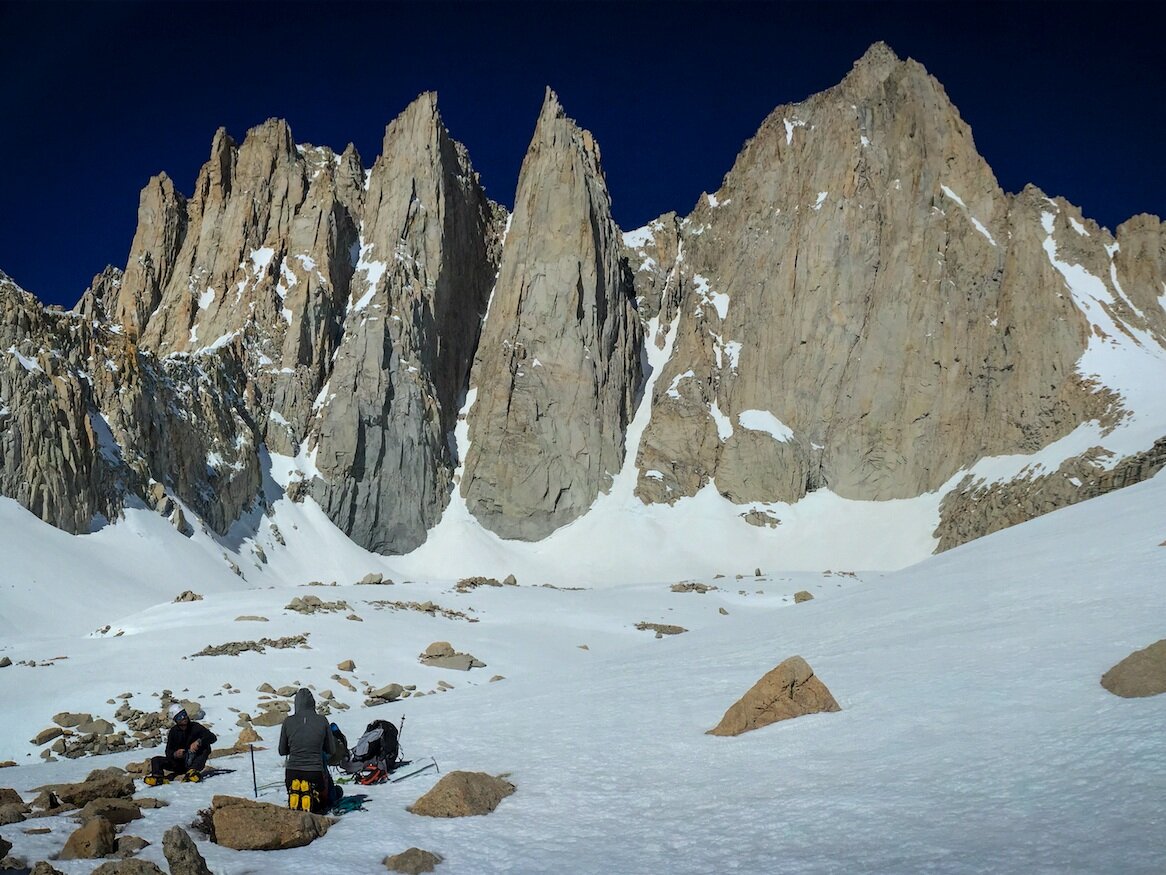
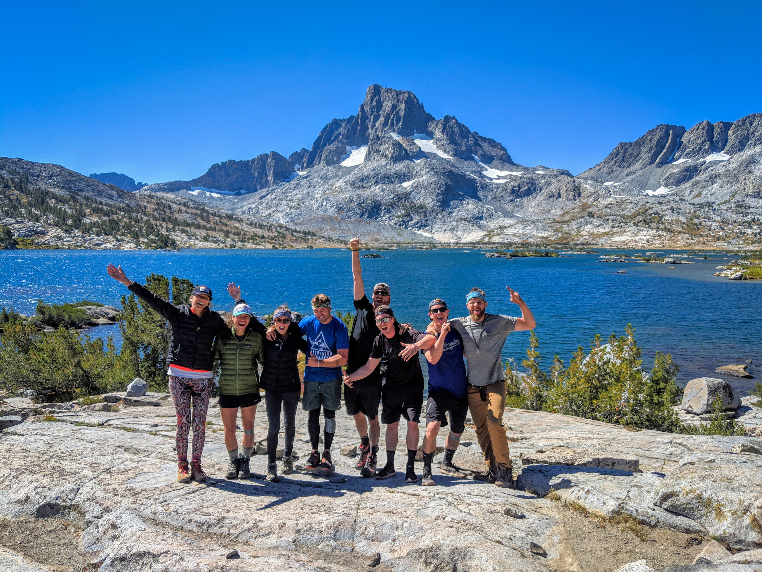
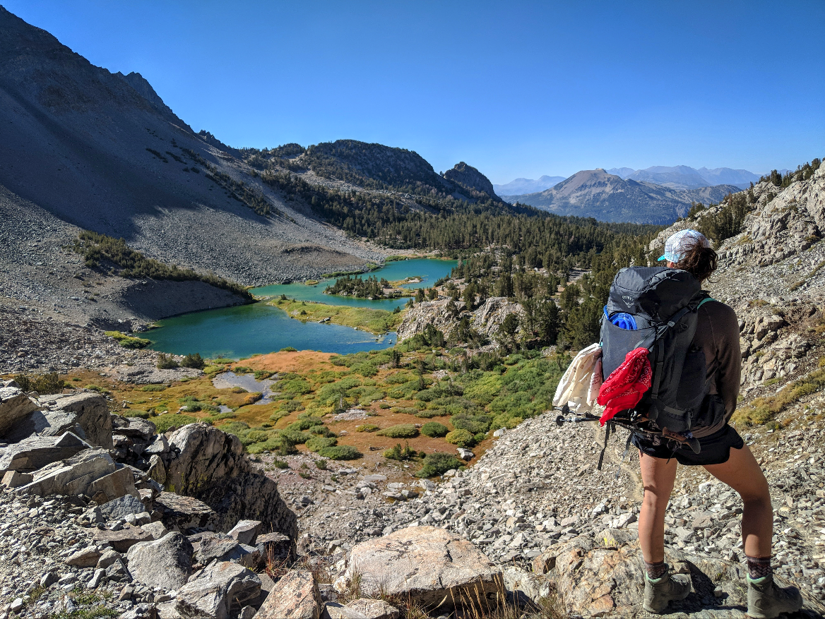
Photo: Group pulling inspiration from Garnet Lake, Mt. Ritter and Banner Peak after a long day of uphill hiking. One more push left until Thousand Island Lake!
Summary - A wildly popular and challenging hike straight into the heart of the jaw-dropping Ritter Mountain Range—what many people argue is Mammoth’s most beautiful landscape. Sitting directly below the summit of the towering 12,900ft. Banner Peak, Thousand Island Lake can be reached in a single day’s hike via three different trails, each with a completely different adventurous look & feel.
It’s the quintessential High Sierra backpacking experienced, and you can do it in a single weekend.
Seasonal Timing - Mid July through early October
Distance and Elevation Gain
Day 1 - Agnew Meadows Trailhead to Thousand Island Lake via the John Muir Trail - 10.6 miles
Lowest Elevation: 8,340 ft. - Agnew Meadows Trailhead
Highest Elevation: 9,833 ft. - Thousand Island Lake
Largest Elevation Gain/Loss: +1,493 ft.
Day 2 - Thousand Island Lake to Agnew Meadows Trailhead via the PCT High Trail - 8.5 miles
Highest Elevation: 9,833 ft. - Thousand Island Lake
Lowest Elevation: 8,340 ft. ft. - Agnew Meadows Trailhead
Largest Elevation Gain/Loss: -1,493 ft.
Total Mileage: 19.1 mi.
Options for Completing the Hike
The PCT High Trail (8.5 mi.) - Heavy elevation gain near the Agnew Meadows trailhead, which then flattens out and follows an stunningly scenic ridge (the right half of the loop on the attached map), which overlooks the San Joaquin River valley toward the Mt. Ritter Range and the Minarets. An absolute must-do—just know there’s very little shade on this route; it may not be the best option on a blistering hot day.
Photo: This loop follows the JMT (left) and the PCT (right). Not pictured is the River Trail, which bisects these trails along the bottom of the valley. | Courtesy via: GregLamy.net
The JMT via Shadow Lake (10.6 mi.) - The longest and most difficult route, but also the most beautiful. It starts down the River Trail but then takes a 90 degree turn and heads straight up into the Ritter Range (the left half of the loop on the attached map). You’ll hike along Shadow Lake and Garnet Lake, and you’ll feel like you’re walking right underneath the Minarets. Shade is moderate on this route, with some heavily shaded areas followed by stretches of sun exposure.
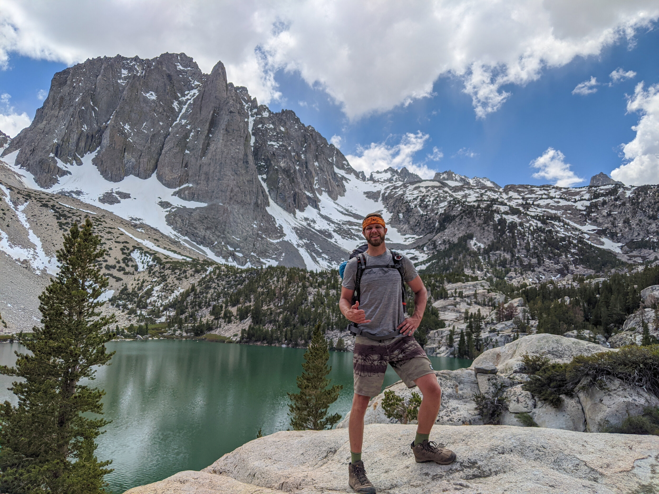
Optional Detour to Ediza Lake - If you take this route, a 1.6 mi. out-and-back trail from Shadow Lake to Lake Ediza lets you camp at the base of the Minarets (Highly Recommended)!
The River Trail (7.8 mi.) - Easy, consistently shaded, flat along the river and straight down the middle. It’s the most direct route to Thousand Island Lakes and is still very beautiful, but aesthetically doesn’t compare it to the other two.
Our Recommendation - We went out on the JMT and back via the PCT, although the reverse order of that route would have been just as beautiful. We only had two days and didn’t have time to camp under the Minarets at Lake Ediza. If you have a third day, ABSOLUTELY add that in.
Permits and Reservations
There are two ways to secure a backcountry camping permit in the Mammoth area, outlined below. For more information, check out our section on Wilderness Permits in Mammoth as well as the Inyo National Forest Website:
Online - Wilderness permits are required for backcountry camping and can be reserved online at Reservation.gov up to six months in advance.
As a Walk-In - We acquired our permits in-person from the Mammoth Lakes Welcome Center. Permits become available as soon as the center opens on the day before your intended departure. You can also rent your bear canisters from the same desk that issues your permit (see below).
For the record, we had zero issues acquiring permits this way. Maybe July is busier, but on a Friday in mid September, we showed up 15 min. before before opening and secured a group of eight people for the following morning. If you have the flexibility in your schedule, this method is a lot easier than applying online six months in advance.
Reaching the Trailhead - Take Minaret Vista Rd. to the Agnew Meadows trailhead where you start the hike. Note: there’s a $10 per vehicle entry fee to drive down Minaret Vista Rd. (fee waived if you have the America the Beautiful National Parks Pass).
Setting Up Your Shuttle - The hike itself is a loop that doesn’t require a shuttle. However if you have more than one car, you may want to pack your gear up at the Minaret Vista toll station parking lot and shuttle down to Agnew Meadows in a single vehicle. In addition to the limited parking at Agnew Meadows, you’ll save money on the entry fee.
You can also park at the Mammoth Adventure Center (ski resort) parking lot and take a public shuttle bus to Agnew Meadows for a minimal fee.
What to Pack
In addition to regular backpacking gear, we’d recommend the following standout items:
Bear canisters, which can be rented from the Mammoth Lakes Welcome Center where you pick up your permit (they’re just a few bucks a day).
Your fishing gear! You can fish REAL native trout at both Garnett and Thousand Island Lake, and I believe you can eat what you catch. See general Mammoth Lakes fishing info here; see Garnett and Thousand Island Lake fishing info here; I also found a great fly fishing forum for Thousand Island Lake here.
A water filter.
Warm clothing & sleeping bag. It might be hot down at the trailhead, but even in the middle of summer, nights are often cold and windy up at the 9,900 ft. shore of Thousand Island Lake.
An anti-venom kit (hopefully never used).
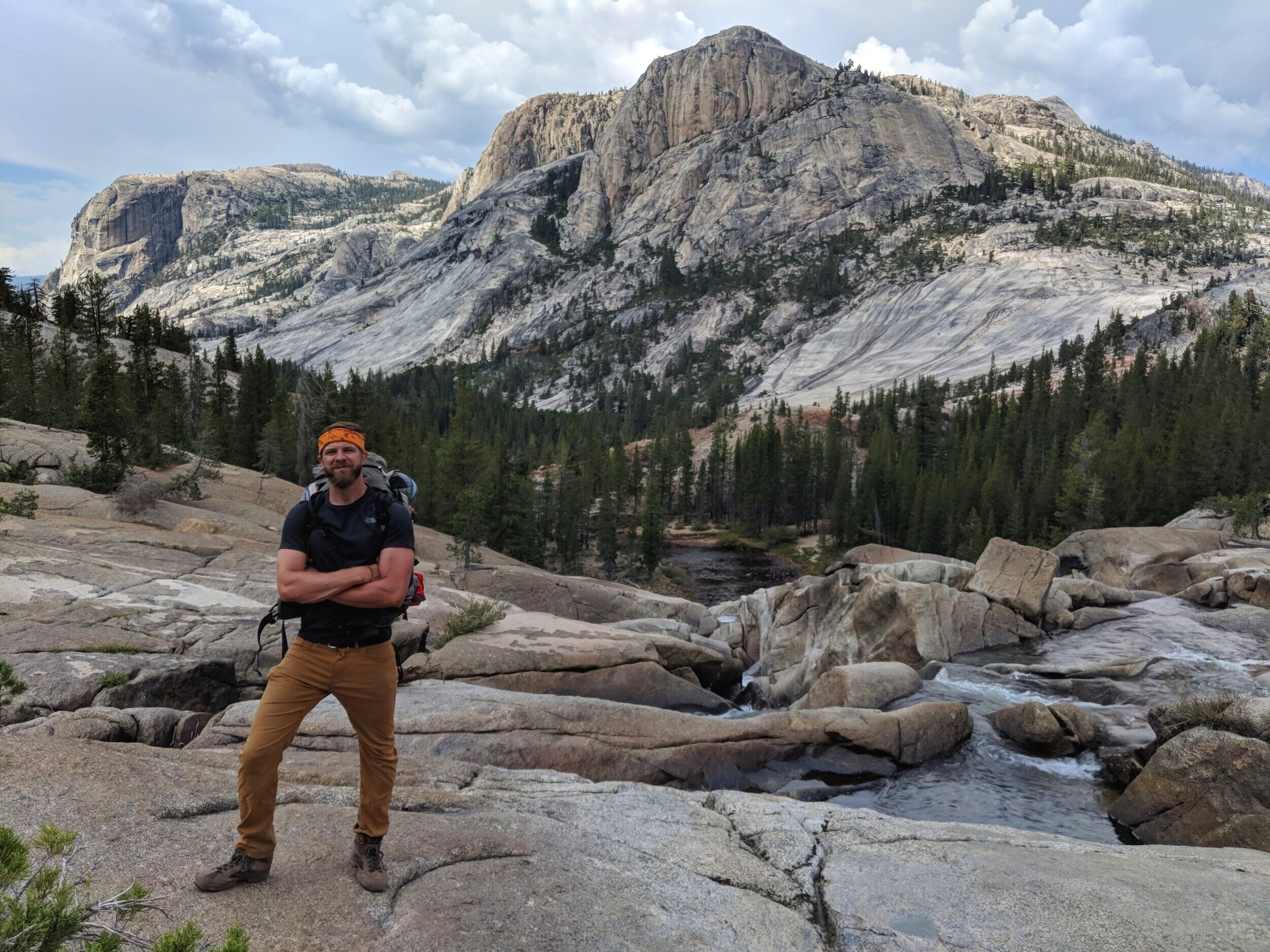
Photo: It’s a beautiful grind up to Shadow Lake on the JMT.
Day of the Hike
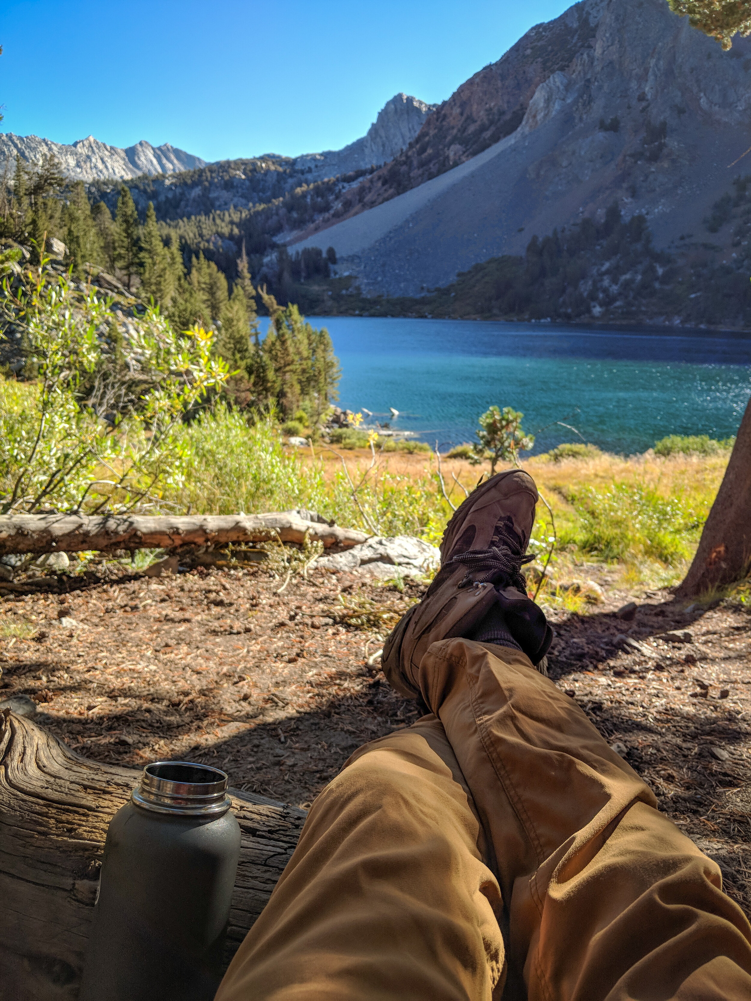
Setting Up Camp: Once you arrive at Thousand Island Lake, the last thing you’ll want to do is hike another mile to your campsite. I’m telling you, it’s worth it. The available camping area is roughly a mile long, and the best campsites start at least a half-mile in. Just keep hiking—you’ll know when you see them.
Fresh Water Sources: Finding fresh water to filter clearly won’t be an issue if you’re following the River Trail or the JMT via Shadow Lake. On the PCT high trail, we crossed at least 8-10 downward flowing streams with steady volume, even late in the season. You should have plenty of water on that route just about any time of year as well. As always, confirm with the rangers when you pick up your permit.
Stay Safe
Check snow and water levels before you leave.
Treat all water along the trail before drinking it.
Approved bear proof canisters are REQUIRED.
To preserve important local wildlife, camping is not allowed at the mouth of Thousand Island Lake. The Mammoth Welcome Center rangers will map out the appropriate camping area (which is a better location anyway) when you pick up your permit.
Campfires are not allowed within a 1/4 mile of Thousand Island Lake.
Unexpected Challenges - You may feel the effects of elevation on this hike.
Resources
Backpacker.com - Thousand Island Lake Loop - Hike to the Best Views in the Ansel Adams Wilderness (out: PCT, back: JMT)
GregLamy.net - 1000 Island Lake Loop Hike (out: PCT, back: JMT)
HikesPeak - Thousand Island Lake via the PCT High Trail
ModernHiker - Thousand Island Lake via the River Trail
Group celebration in front of Banner Peak at Thousand Island Lake
Two backpackers on the PCT looking across the valley at Shadow lake, with the sawtooth peaks of the Minarets lingering behind
Photo: Our group slogging up the JMT toward Shadow Lake on the journey out. Every step of this hike was jaw-dropping!
Photo: The PCT on the way back is absolutely beautiful, but also very exposed.
Want More Adventure??
Check out our other popular posts!